Estimating Daily Soil Erosion in Nebraska
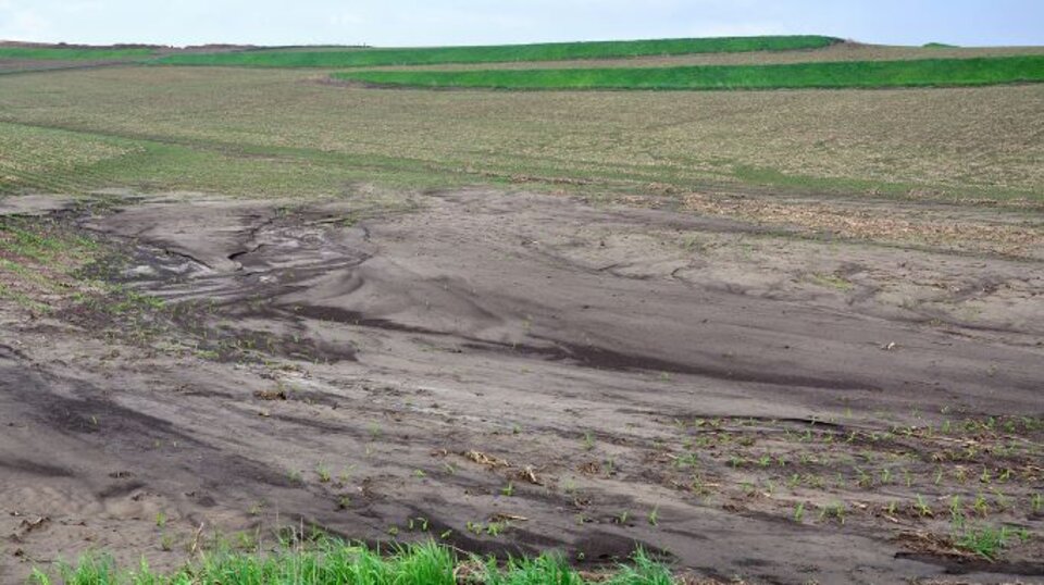
Photo above of soil erosion is from the USDA Natural Resources Conservation
Soil erosion and subsequent sediment delivered to streams and lakes is a serious water quality problem in Nebraska. Sedimentation of small reservoirs reduced flood-holding capacity. High nutrient runoff can lead to harmful algal blooms.
Nebraska now has a way to estimate the relative amount of soil erosion across the state on a daily basis. The Daily Erosion Project (DEP) is a real-time, computer-based, daily estimate of soil erosion and water runoff occurring on hill slopes in sample watersheds across the state. The DEP is operated by Iowa State University and originally estimated daily soil erosion in Iowa. Funding support has allowed the project to extend across Nebraska.
The DEP is updated daily based on actual rainfall, soil type, land slope, and estimated land cover and management identified via remote sensing tools. If ample rainfall occurs soil erosion and water runoff from sample hillslopes within watersheds across the state are updated daily based on HUC watersheds and results are presented at the DEP interactive website (https://www.dailyerosion.org/).
Estimates by the DEP are made with the Water Erosion Prediction Project (WEPP) hillslope erosion simulation model developed over the past thirty years by the USDA Agricultural Research Service. Current high-speed computing allows the WEPP computer model to compute over 200K model runs per day, completing and publishing the previous days results usually by 6:00 a.m. the next day. A Twitter account, @dailyerosion, can provide a notice when the results have been posted.
The website includes an interactive menu which can be used to select dates in the past to see the erosion and runoff from any day of the year. Look back on the day of the big rain in your watershed and see what the estimated erosion was. The values you see will be an estimate based on an average land use condition for the watershed, focused on agricultural land use. Any given field will yield more or less soil erosion than what is published depending on the land use of that field and the amount of rainfall and runoff that actually occurred.
To get more information or to view the daily results map go to the Daily Erosion Project website at https://www.dailyerosion.org/>.
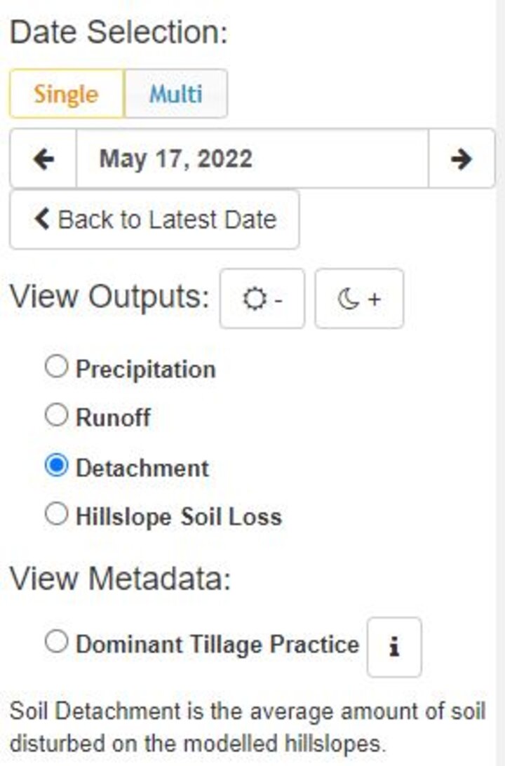
Above: DEP Date Selection Menu
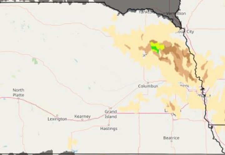
Above: DEP soil erosion estimate map. The green color indicates an estimated soil loss of 4.32 tons per acre after 2.04 inches of rainfall on May 17, 2022.
This article was reviewed by Kelly Feehan